Still doing it the old way?
Paper plans are impractical in the field
Manual staking is slow and expensive
Field documentation disconnected from office
No real-time position on your plans
Sketches and measurements are tedious
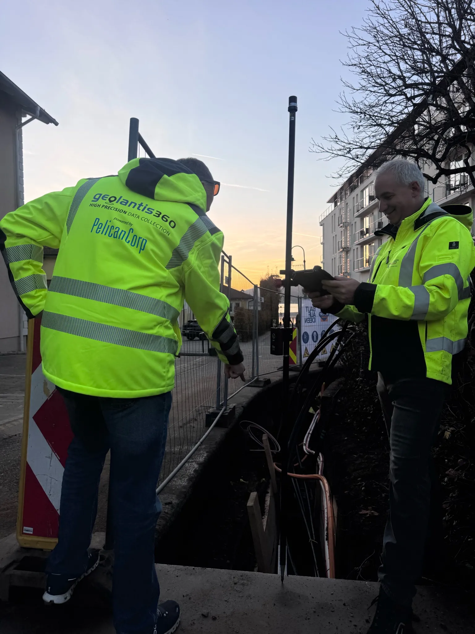
One field app for the whole survey workflow
Measure, stake out, document, and sync — to centimetre accuracy, with no surveyor on standby.
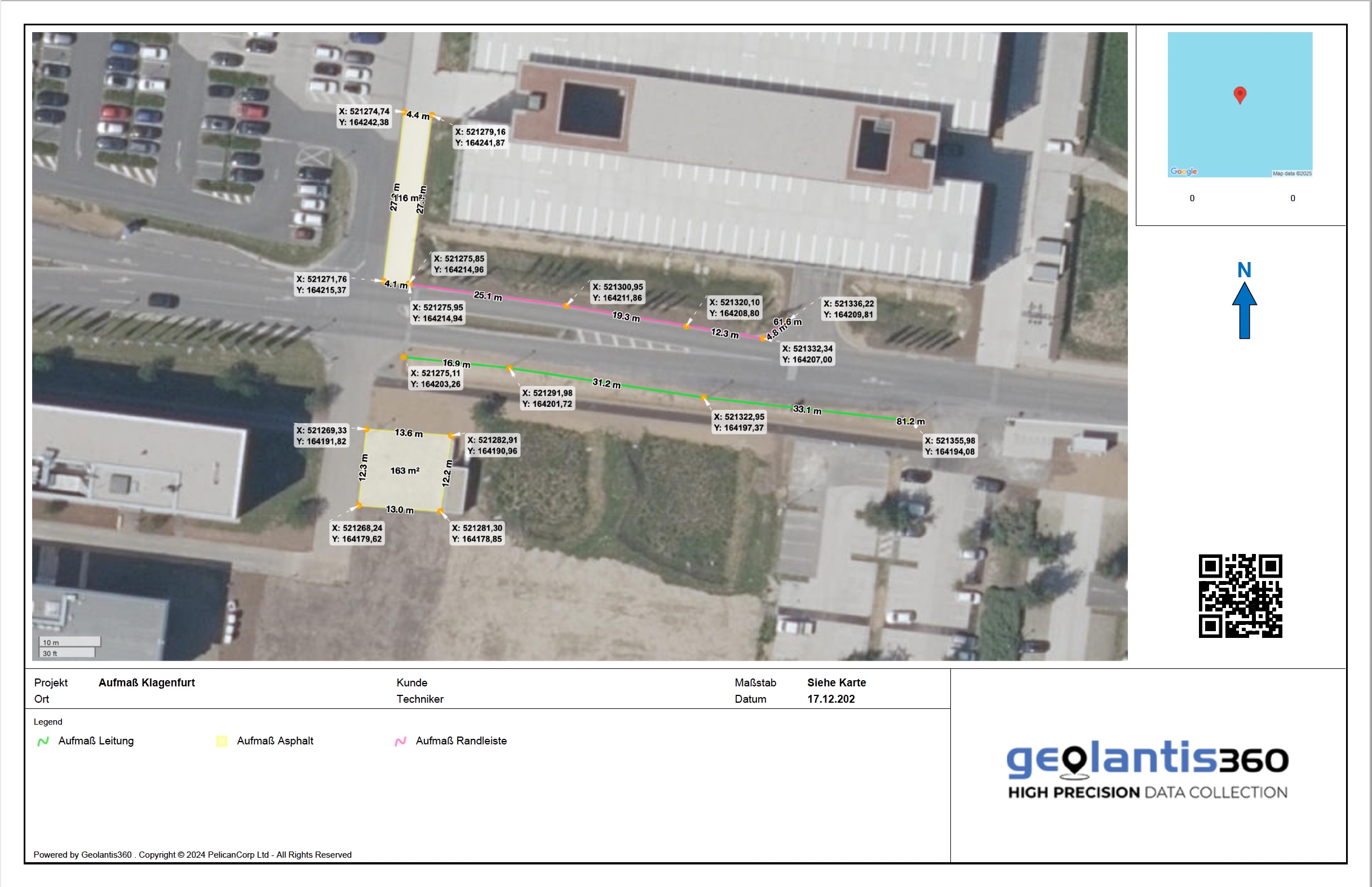
Digital field measurement
Survey sites in a fraction of the time
Capture points, lines, and areas with centimetre-accurate GNSS — no measuring wheel, no clipboard. Lengths, areas, and perimeters are calculated on the spot.
- Up to 4× faster than tape-and-wheel methods
- Automatic length, area, and perimeter calculation
- Audit-ready PDF measurement reports
- Export to TXT, SHP, DXF, and PDF
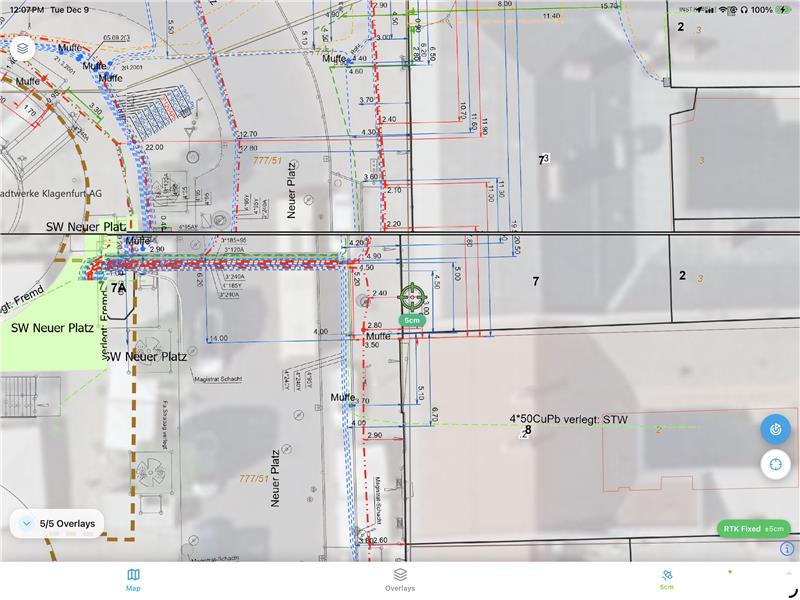
Stakeout & localization
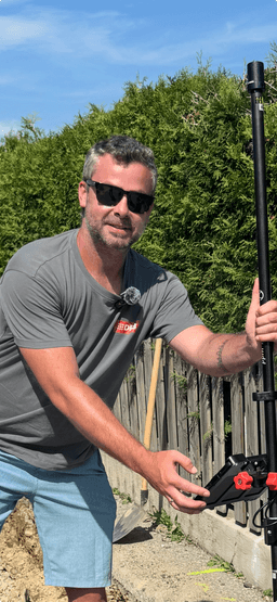
Set out points yourself — no waiting on a surveyor
Navigate to design points with live GNSS guidance and stake them out to centimetre accuracy. Your trained crew starts immediately.
- Up to 80% lower surveying cost
- Start on site with no external scheduling
- ±1 cm horizontal & vertical RTK precision
- Import coordinate lists from planning software
Geotagged photo documentation
Every photo in the right place
Each photo is automatically tagged with precise GPS coordinates and placed on the plan and map — watertight evidence for billing and as-builts.
- Automatic GPS coordinates on every photo
- Instant placement on plan and map
- Solid basis for billing and claims
- Real-time sync to the office
Field-to-office sync
Everyone on the same data, instantly
Cloud sync keeps the field and the office on the latest data in real time — with a complete, traceable project history. Works offline and catches up when you reconnect.
- Real-time cloud sync between field and office
- Full offline capability on site
- Complete, traceable project history
- Live overview of progress for the whole team
Up to 80% time savings
Teams using GeolantisNEO measure faster, stake out themselves, and bill with confidence.
See GeolantisNEO in action
Swipe through the field app — tap any screen to enlarge.
Trusted by survey and construction teams
350,000+ projects digitized


"With GeolantisNEO, we reduced our documentation time by 75% while increasing data quality. Geolantis is now indispensable."
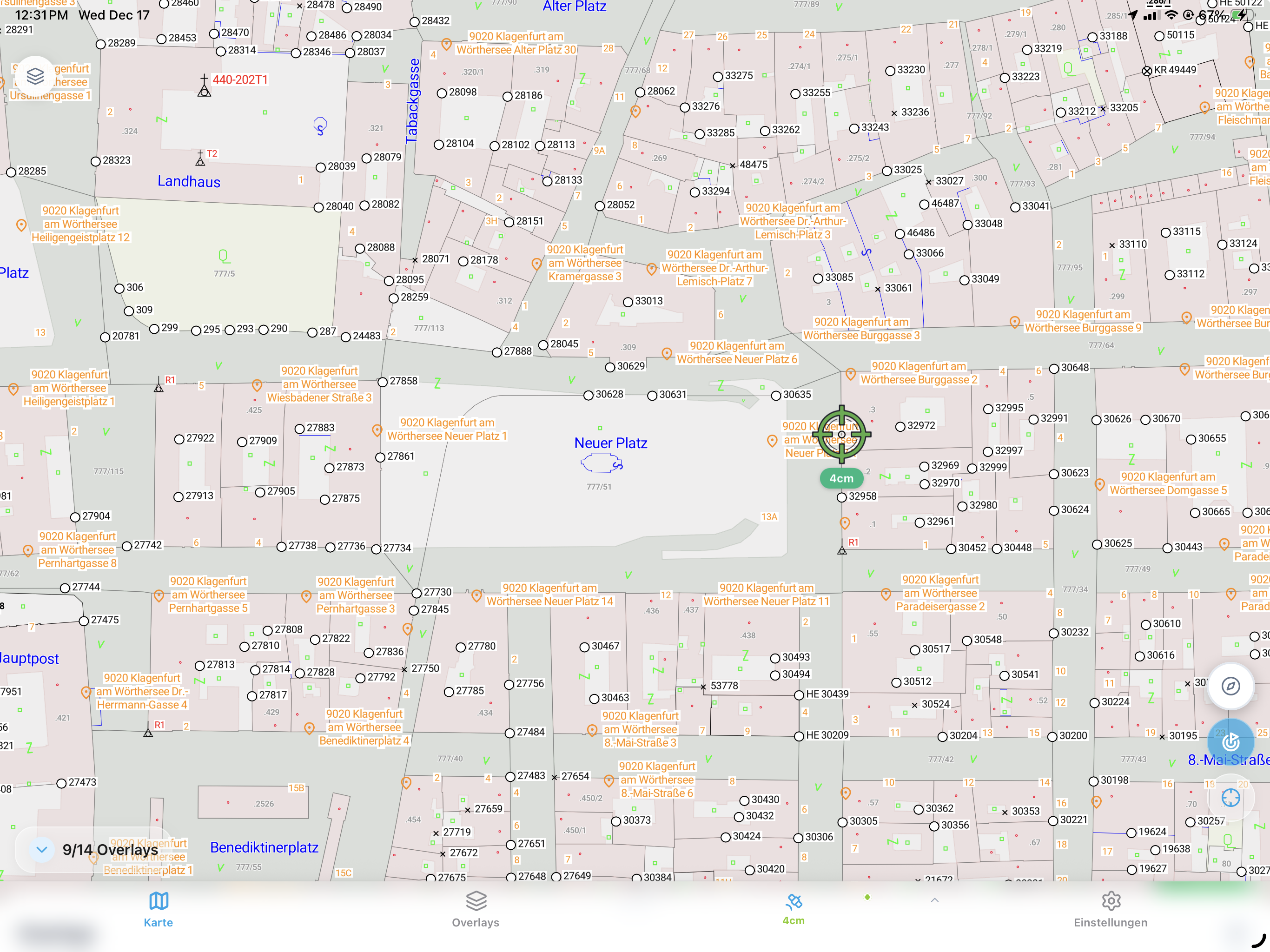
Global Basemap Coverage
Official cadastral and orthophoto basemaps across many countries.
Works with your receiver
Connect the GNSS receiver you already own — no new hardware required.


…or connect any NTRIP / RTCM correction source.
Full device list and platform compatibility available in the app.
Get the app
Scan the code to install GeolantisNEO on your phone or tablet.